What is Forest Inventory?
Forest inventory refers to the process of systematically collecting and analyzing data about the trees and vegetation within a forested area. This data is crucial for understanding the composition, structure, and health of the forest, and it serves as the foundation for making informed management decisions. Here’s a breakdown of how drones can be used for forest inventory assessments:
Example Sub Title
In modern forestry management, the integration of drone technology with advanced machine learning algorithms has revolutionized the process of tree species identification within forested landscapes.
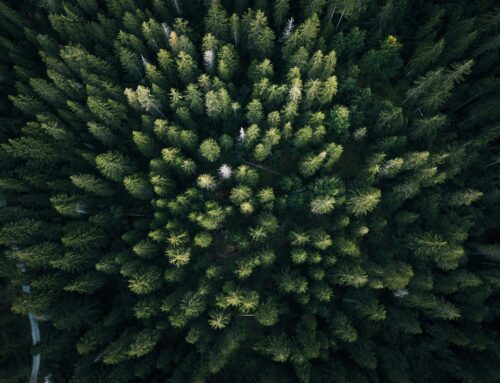
By deploying drones equipped with high-resolution cameras and multispectral sensors, forestry professionals can capture detailed imagery of the forest canopy, unveiling the intricate tapestry of vegetation below.
This wealth of data, spanning across various wavelengths of light, serves as the foundation for employing sophisticated image processing techniques and machine learning algorithms. Through the extraction of key features and spectral signatures unique to different tree species, these algorithms possess the remarkable capability to discern and classify individual trees with remarkable accuracy.
As a result, they provide invaluable insights into the diversity and distribution of tree species within forest ecosystems.
Data Collection: Drones equipped with high-resolution cameras and multispectral sensors are flown over the forest canopy to capture imagery of the trees. The imagery includes data across various wavelengths of light, providing detailed spectral information about the vegetation.
Image Preprocessing: Before analysis, the captured images undergo preprocessing to enhance their quality and remove any noise or distortions. This step ensures that the data fed into the machine learning algorithm is clean and accurate.
Feature Extraction: Machine learning algorithms then extract features from the preprocessed imagery. These features may include shape characteristics, texture patterns, and most importantly, spectral signatures of the trees. Spectral signatures represent the unique reflectance patterns of different tree species across various wavelengths of light.
Training the Algorithm: The extracted features are used to train a machine learning algorithm, such as a convolutional neural network (CNN) or a random forest classifier. The algorithm is trained on a labeled dataset containing examples of different tree species and their corresponding spectral signatures.
Classification: Once trained, the machine learning algorithm can classify new drone imagery into different tree species categories based on their spectral signatures. By comparing the spectral characteristics of the trees in the imagery to those in the training dataset, the algorithm can accurately identify the species present within the forest canopy.
Validation and Refinement: The accuracy of the machine learning model is validated using additional datasets or ground truth data collected from the field. Any misclassifications or errors are identified, and the model is refined or fine-tuned accordingly to improve its performance.
Application: The trained machine learning model is then applied to analyze large-scale drone imagery datasets of forested areas. It automatically identifies and maps out the distribution of different tree species within the forest canopy, providing valuable insights into the diversity and composition of the forest ecosystem.
By using machine learning algorithms for tree species identification, logging companies and conservation organizations can efficiently and accurately assess forest biodiversity, monitor changes over time, and make informed management decisions to support sustainable forestry practices.
Utilizing Black Walnut Trees (Juglans nigra) strategically on the farm can offer multifaceted benefits beyond timber and nut production. Their allelopathic properties, while inhibiting the growth of certain plant species, can be leveraged for effective weed management and ecosystem health.
By choosing plant species that are tolerant or resistant to juglone, farmers can create a harmonious agricultural ecosystem that minimizes competition and maximizes resource utilization.
Natural Barriers Against Invasive Weeds: Planting Black Walnets Along The Perimeters
For instance, when planning the layout of the farm, one might strategically place Black Walnut Trees along the perimeters or interspersed throughout fields to create natural barriers against invasive weeds. This strategic placement can help reduce the need for synthetic herbicides, contributing to a more sustainable farming approach.
Companion Plants that are Less Sensitive to Juglone
Moreover, selecting companion plants that are less sensitive to juglone can further enhance the productivity of the farm. For example, crops such as corn, squash, and asparagus are known to tolerate juglone and can be cultivated alongside Black Walnut Trees without significant inhibition. Integrating these compatible crops into the farm’s bioplan not only maximizes land utilization but also promotes biodiversity and crop diversity.
Additionally, considering the allelopathic properties of Black Walnut Trees can guide the selection of cover crops or ground cover vegetation. Opting for species that thrive in the presence of juglone can help suppress weed growth, improve soil health, and enhance overall farm productivity.
Strategic Planting: Harnessing Drones for Precision Land Managemen

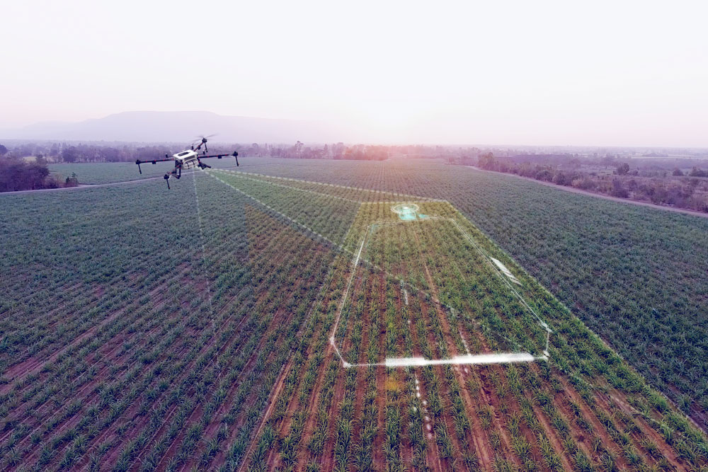
Integrating drone technology for land surveying offers an innovative approach to strategically plan the placement of Black Walnut Trees (Juglans nigra) on farms or backyard homesteads. Drones equipped with high-resolution cameras and mapping software provide detailed aerial imagery and data, enabling farmers and landowners to make informed decisions about tree placement and overall land management. Here’s how drone technology can be utilized for this purpose:
<b>Aerial Mapping and Imaging:</b> Drones capture high-resolution aerial images of the land, providing a comprehensive overview of the terrain, vegetation cover, and existing land features. These images offer valuable insights into the topography of the land, allowing farmers to identify suitable planting areas for Black Walnut Trees.
<b>Site Assessment and Analysis: </b>Using drone imagery, farmers can conduct detailed site assessments to evaluate factors such as <b>soil composition, drainage patterns, and sunlight exposure across the property</b>. By analyzing this data, farmers can identify optimal locations for planting Black Walnut Trees that meet the species’ requirements for well-drained soil and adequate sunlight.
<b>Precision Planning and Mapping:</b> Drone technology enables precision planning and mapping of tree planting locations. By overlaying drone imagery with mapping software, farmers can delineate planting zones and designate areas for Black Walnut Tree cultivation based on factors such as soil quality, slope, and proximity to existing infrastructure.
<b>Optimizing Spacing and Density: </b>Drones facilitate accurate measurement and analysis of land area, enabling farmers to optimize tree spacing and density for maximum productivity and growth. By strategically planning the placement of Black Walnut Trees, farmers can ensure efficient use of available space while minimizing competition between trees and maximizing access to resources such as sunlight and water.
<b>Long-Term Monitoring and Management: </b>Drones provide a cost-effective means of long-term monitoring and management of tree plantings. By conducting periodic aerial surveys, farmers can track the growth and health of Black Walnut Trees over time, identify any issues or challenges, and implement proactive management strategies as needed to ensure their continued success.


