Introduction


In the US, airspace is categorized into different types, each with specific regulations and requirements. As you see in the FAA graphic above, there is Class A, B, C, D, E and G airspace.
Each airspace type comes with its own set requirements and regulatory laws. If you’re flying your sUAS anywhere near or within these airspaces, you absolutely need to know what is required, or not allowed, not just for your own safety but for the safety of those flying in the air near you.
Exam Prep:
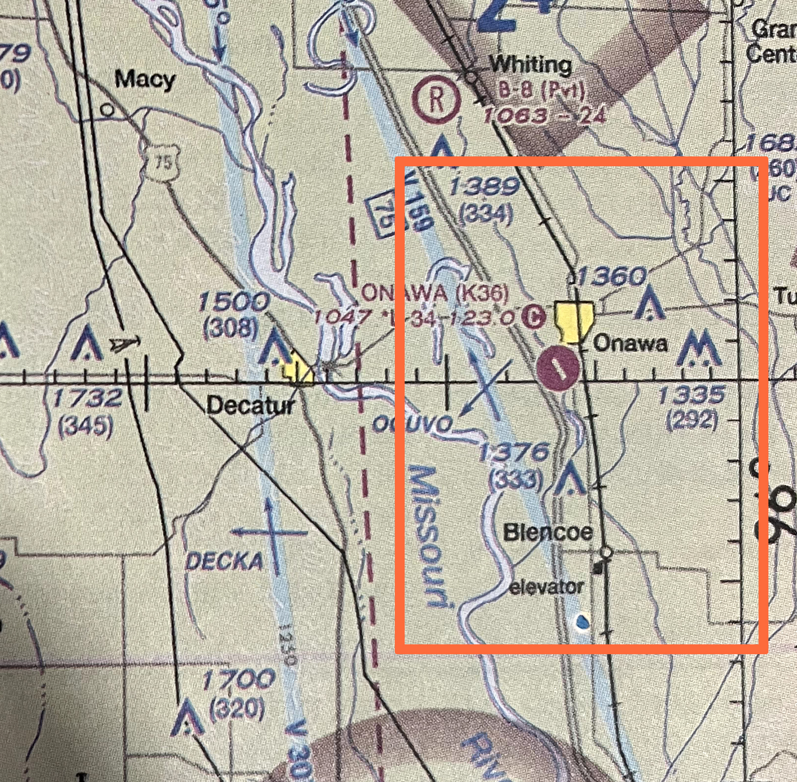
On the Part 107 exam, you’ll encounter images of sectional charts and be asked to identify all kinds of information.
Class B Airspace
Requirements + Surface / Ceiling / Radius
Class B Airspace Flight Requirements:
Control Tower Present: YES
Class B is a towered airspace surrounding major airports with extensive Air Traffic Control services, managing aircraft operations within this airspace and providing separation between aircraft.
Communication with ATC Required: YES
Pilots must obtain clearance from ATC before entering Class B airspace and maintain communication while within it through two-way radio.
Specialized Equipment Required: YES
Requires Mode C Transponder, ADS-B Out, and Altimeter
Class B Airspace Surface / Ceiling / Radius

The layers of Class B airspace are more complex, and the altitude boundaries vary depending on the specific design of the airspace. Typically, Class B airspace consists of concentric rings (or layers) with increasing radius as you move outward from the airport, and the altitudes within those layers can vary.
Here’s a general breakdown of the layers in a standard Class B airspace:
- Layer 1 (Innermost Ring):
- Radius: 0 to 5 nautical miles (NM) from the airport center.
- Floor: Surface (0 feet AGL).
- Ceiling: 10,000 feet MSL (this can vary based on the specific airport layout, but it’s typically around 10,000 feet MSL).
- Layer 2 (Middle Ring):
- Radius: 5 to 10 NM from the airport center.
- Floor: 1,200 feet AGL.
- Ceiling: 10,000 feet MSL (or lower, depending on the specific layout).
- Layer 3 (Outermost Ring):
- Radius: 10 to 20 NM from the airport center.
- Floor: 2,400 feet AGL.
- Ceiling: 10,000 feet MSL or higher, depending on the specific configuration of the airspace.
- In terms of AGL (Above Ground Level), Layer 3 would typically extend up to 7,600 feet AGL (since the ceiling is 10,000 feet MSL and the floor is 2,400 feet AGL). The exact height can vary depending on the specific airport and the terrain in the area.
Class C Airspace
Requirements + Surface / Ceiling / Radius
Class C Airspace Flight Requirements:
Control Tower Present: YES
Class C is a towered airspace surrounding large airports with Air Traffic Control services, managing aircraft operations within this airspace and providing separation between aircraft.
Communication with ATC Required: YES
Pilots must obtain clearance from ATC before entering Class C airspace and maintain communication while within it through two-way radio.
Specialized Equipment Required: YES
Requires Mode C Transponder, ADS-B Out, and Altimeter

Class C Airspace Surface / Ceiling / Radius
Similar to Class B, Class C airspace is like a tiered upside down layer cake. Class C typically consists of two concentric rings, or layers, that extend outward and upward, creating its two-tiered structure.
- The lower shelf, which is the inner core, extends vertically from the ground up to 1,200 feet AGL, and has a radius of 5 nautical miles.
- The outer shelf starts at 1,200 feet AGL and goes up to 4,000 feet AGL. It has a radius of 10 nautical miles.
Class B and C Indications on
Sectional Charts
Class C: Marked by Solid Magenta Lines
Class B: Marked by Solid Blue Lines
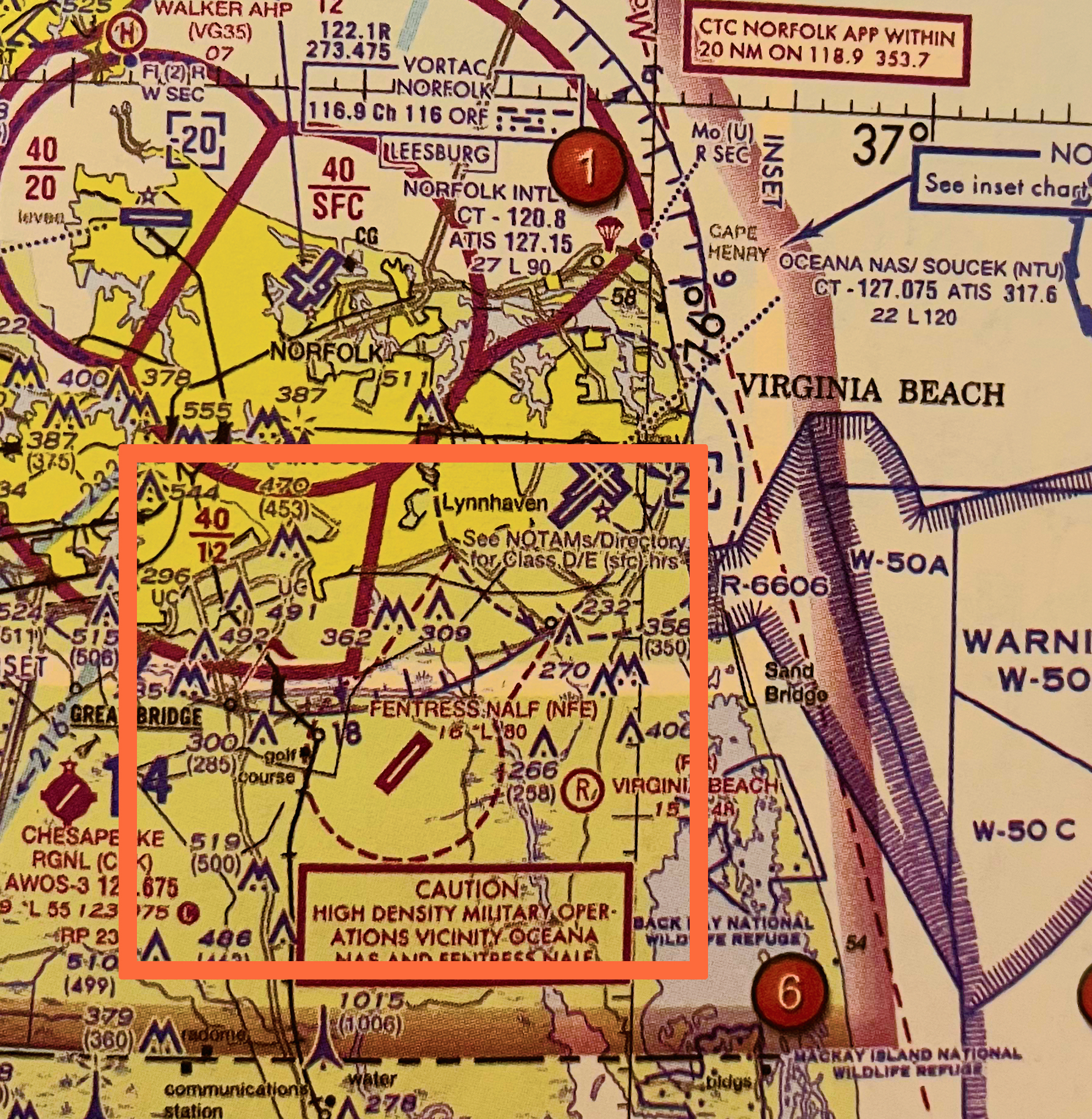
Class C on Sectional Charts: Solid Magenta Line
Class C airspace is depicted on sectional charts with a solid magenta line. It typically has a cylindrical shape around the airport, but the exact boundaries are tailored to the airport’s operational needs.
In the image below, Norfolk International Airport is identified as Class C airspace, marked by the solid magenta lines that encircle it.

Class B on Sectional Charts: Solid Blue Line
Class B airspace is depicted on sectional charts with a solid blue line. It typically has a cylindrical shape around the airport, but the exact boundaries are tailored to the airport’s operational needs.
In the image below, Dallas/Ft Worth International Airport (DFW) is identified as Class B airspace, marked by the solid blue lines that encircle it.