Introduction
Finding the right communication frequencies for specific airspace is straightforward when you know what to look for, and there are two main ways to identify them:
- Figure 1 illustrates how airport legends on sectional charts clearly display communication frequencies such as CTAF, UNICOM, and ATIS. This serves as a quick-reference tool while planning or navigating.
- Figure 2 demonstrates how the same information is also available in the Chart Supplement. In this example, we highlight Boulder Municipal Airport, showing how the Communications section provides all the necessary frequency details for confirmation and accuracy.
This lesson will guide you through these two methods step-by-step, helping you effectively locate and understand the necessary frequencies for your operations.
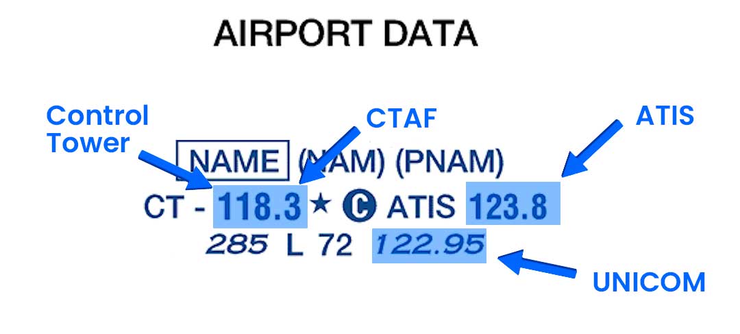
Figure 1
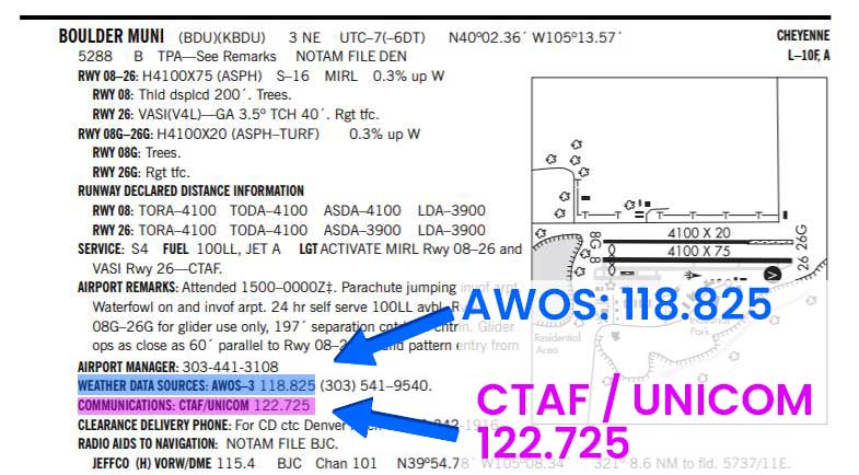
Figure 2
Sectional Chart Practice
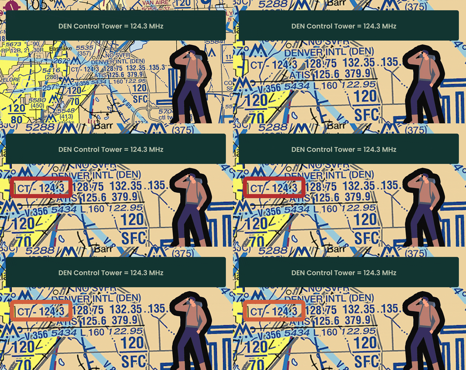
CT (Control Tower) at Denver International Airport (DEN)
Look for the “CT” in the airport legend to identify a control tower at Denver International Airport. This airport is fully staffed with ATC to manage air traffic.
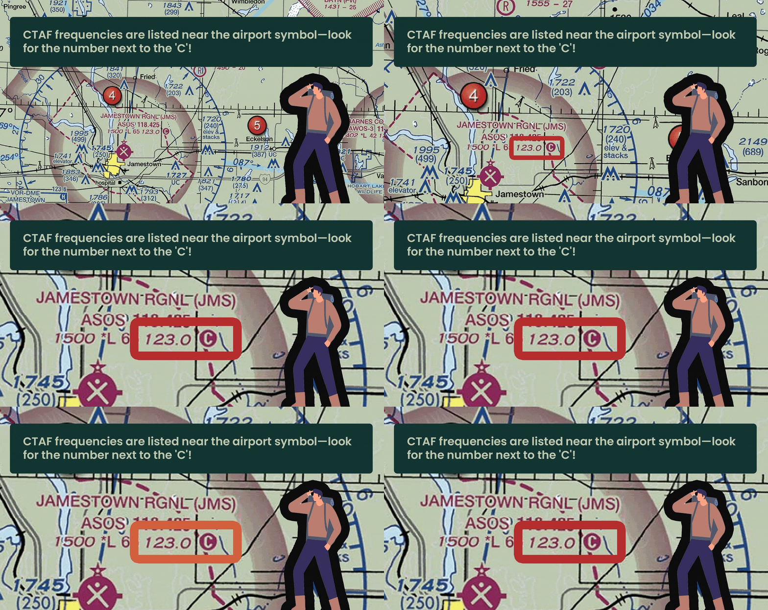
CTAF at Jamestown Regional Airport (RGN)
Look for “C” in the legend to find a designated frequency for coordinating air traffic at Jamestown Regional Airport.
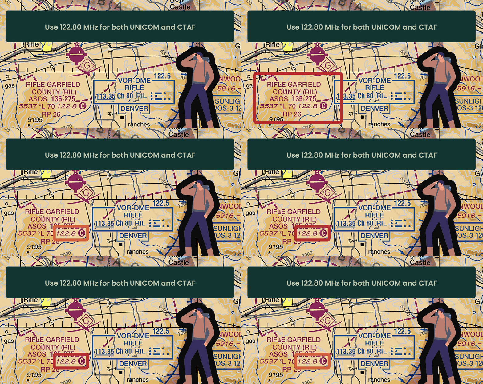
UNICOM at Rifle Garfield County Airport (KRIL)
Check the airport legend for “UNICOM” and the frequency (122.80 MHz). Note that at Rifle Garfield County Airport, the UNICOM frequency is the same as the CTAF for air-to-air communication and coordination with ground services.
*Remember, unless shown separately, UNICOM and CTAF share the same frequency
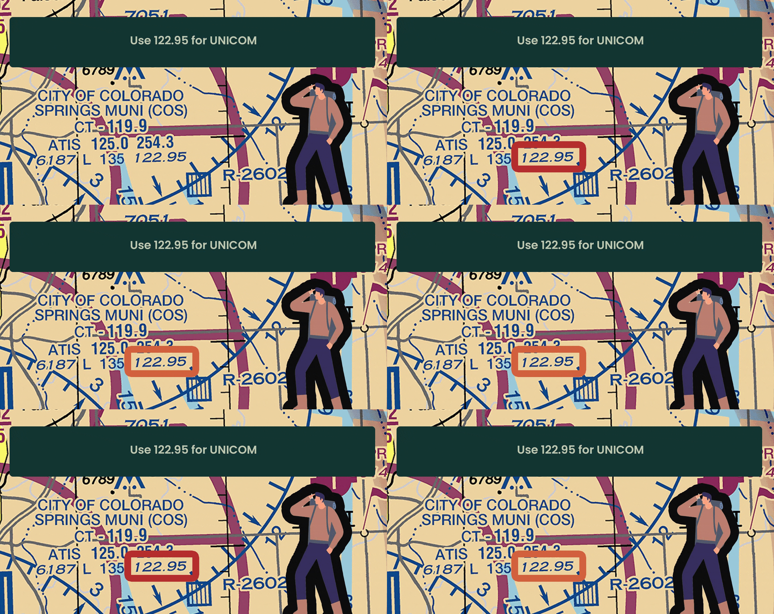
UNICOM at Colorado Springs Airport (COS)
If UNICOM operates on a separate frequency from the CTAF, the UNICOM frequency will be clearly listed in the airport’s chart legend under the communications section.
It will not have the “C” (which signifies CTAF), but will instead be labeled as UNICOM.
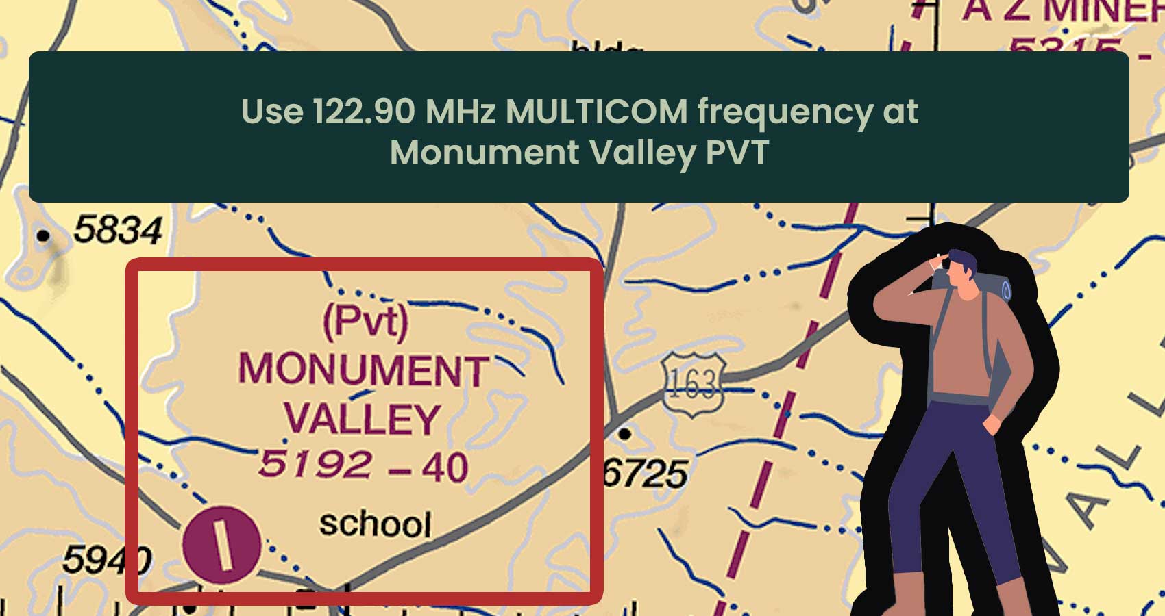
MULTICOM at Monument Valley PVT
Use 122.90 MHz on MULTICOM frequency at Monument Valley PVT (5192-40) for communication in areas without ATC or tower services, such as remote locations or private airports.
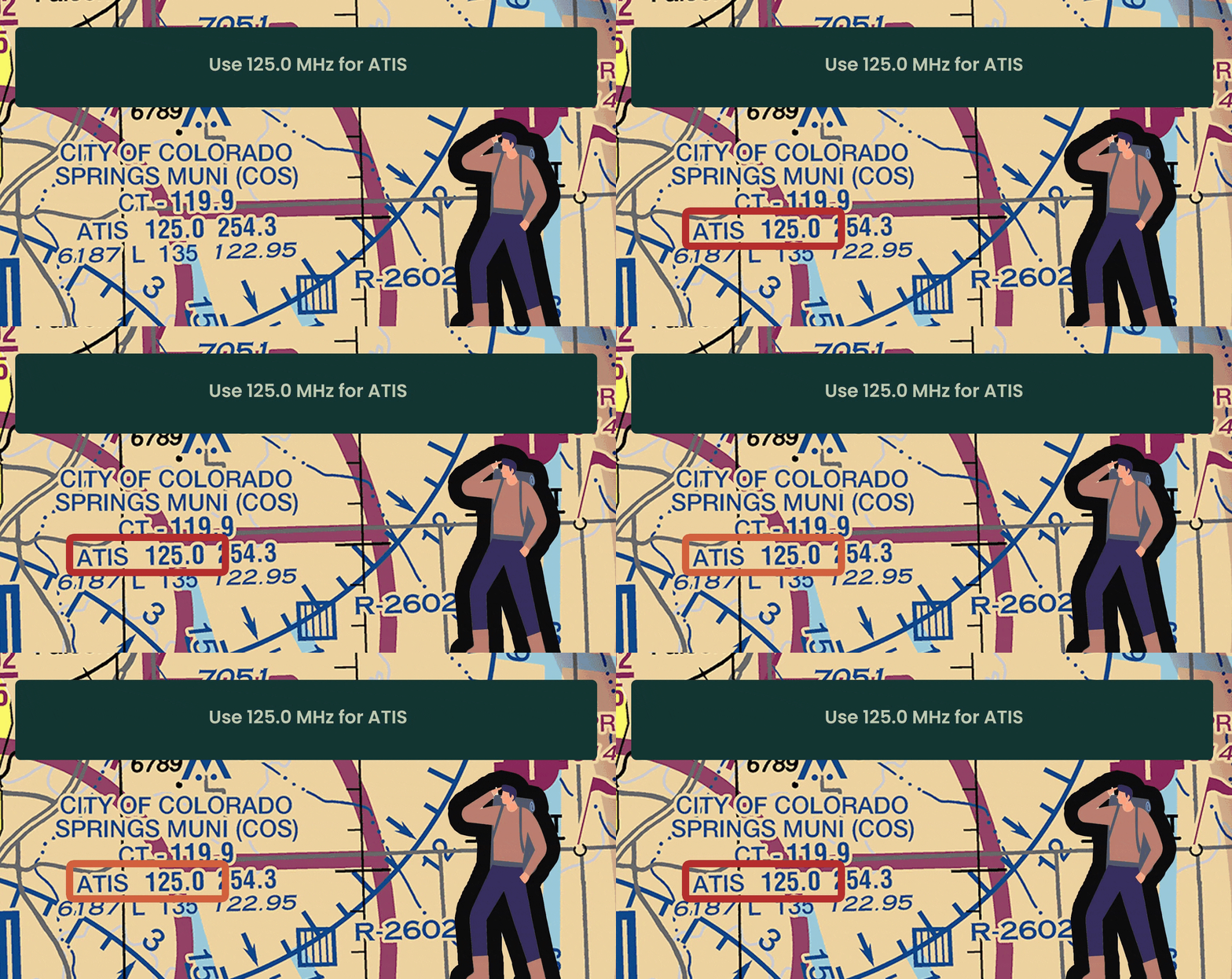
ATIS at Colorado Springs Airport (COS)
Colorado Springs Airport (COS) also uses ATIS to provide essential weather information to pilots, including real-time weather updates, airport information, and traffic advisories. Remember checking ATIS is mandatory before contacting ATC.
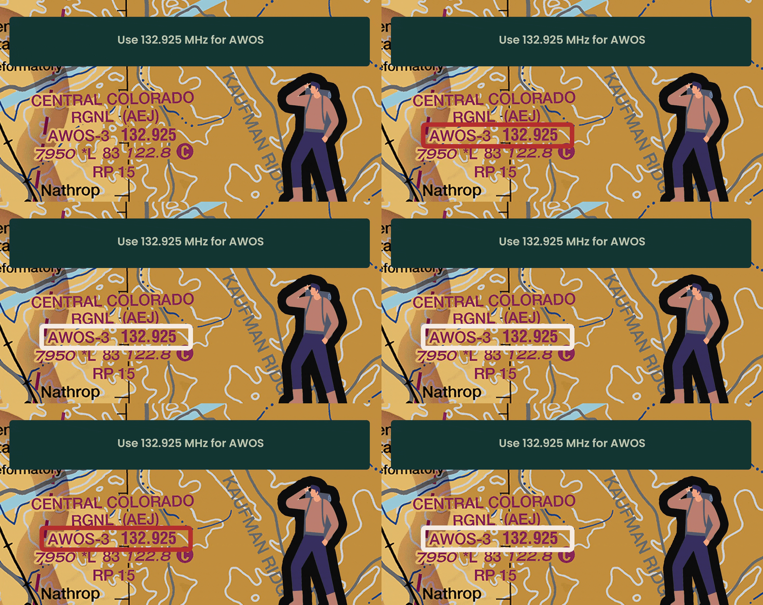
AWOS at Central Colorado Regional Airport (AEJ)
For regional airports like Central Colorado Regional, AWOS provides essential weather information. Here AWOS is shown as 132.925 in the legend.
